Books, Geography, Science/Math

Perfect Picture Book Friday: Island: A Story of the Galapagos

TITLE: ISLAND: A STORY OF THE GALAPAGOS

AUTHOR/ILLUSTRATOR: Jason Chin

PUBLICATION INFO: Roaring Book Press’s Neal Porter Books, 2012

ISBN: 978-1-59643-716-6

SOURCE: Library

INTENDED AUDIENCE: grades 2-4 (Booklist)

GENRE: picture book (nonfiction)

OPENING and SYNOPSIS:

“The sun is rising over a lonely group of islands more than six hundred miles away from the nearest continent.”

Jason Chin, author or REDWOODS and CORAL REEFS, chronicles the “life” of an island from birth six million years ago to old age, when it sinks beneath the sea. During its life, animals come to live on the island and change through natural selection. Chin’s back matter includes pieces about Charles Darwin and the Galapagos Islands.

THEMES/TOPICS: science, natural selection, geography

WHY I LIKE THIS BOOK: This was a bit of a departure from the Jason Chin books I’m familiar with. Normally, he offers a fictional storyline “told” through the illustrations, matched with encyclopedic text. Here, he maps an island’s development to a human life cycle. Illustrations depict the story told within the text.

RESOURCES/ACTIVITIES:

Every Friday bloggers review “Perfect Picture Books.” Find a complete list of book reviews organized by topic, genre and blogger at author Susanna Leonard Hill’s site.

Books, Geography

Perfect Picture Book Friday: THE HATSELLER AND THE MONKEYS

Author/Illustrator: Baba Wague Diakite
Publication Info: Scholastic Press, 1999
ISBN: 978-0590960694
Source: Library
Intended audience: ages 4 and up
Genre: picture book (fiction)
Themes/topics: folk tales, fables, Mali, monkeys, cleverness, tricksters
Opening and synopsis: ”BaMusa the hatseller was a joyful man. He traveled from town to town selling hats, which he piled high on his head.”
Eager to sell hats at the festival, BaMusa sets off without breakfast. Tired and hungry, he lies down for a nap, and clever monkeys steal his hats. BaMusa must figure out how to get them back.
Why I like this book: CAPS FOR SALE by Esphyr Slobodkina is a family favorite. I had no idea that its source was a folk tale that is told in many countries, including Mali. This is the same story set in Mali and illustrated with beautiful ceramic-tile paintings. I also appreciate that this telling of the story emphasizes that BaMusa had not eaten breakfast, so he didn’t have energy and couldn’t think clearly. He can only figure out what to do after he’s eaten. My favorite quote from the book is, “It is with a full stomach that one thinks best.”
Resources/activities: 
  • Diakite includes and author’s note with the history of the folktale, as well as a list of other versions of this tale, including CAPS FOR SALE.
  • Reading to Kids has discussion ideas and a couple of craft suggestions, including making hats or drawing a picture of a saying your mom says.
  • A full lesson plan, including step-by-step hat-making instructions, are at Easy Literacy.
  • Children can learn more about Mali on National Geographic’s site.

Every Friday bloggers review “Perfect Picture Books.” Find a complete list of book reviews organized by topic, genre and blogger at author Susanna Leonard Hill’s site.

Books, Geography, History

Perfect Picture Book Friday: The Wall

Author/Illustrator: Peter Sis
Publication Info: Macmillan’s Farrar, Straus and Giroux, 2007
ISBN: 978-0-374-34701-7
Source: Personal collection
Intended audience: ages 8 and up
Genre: picture book (nonfiction)
Themes/topics: world history, communism, the Cold War, the Iron Curtain, Czechoslovakia, autobiography
Opening and synopsis: “As long as he could remember, he had loved to draw. At first he drew shapes. Then he drew people. After drawing whatever he wanted to at home, he drew what he was told at school.”
This multi-layered, picture-book autobiography recounts Peter Sis’s life growing up in communist Czechoslovakia. Sis writes the main narrative in simple sentences. However, he rings that simple narrative with drawings, captions, excerpts from his journals and historical timeline information.
Why I like this book: This book was a library-book-sale find. I lived in West Germany when The Wall crumbled, and so Sis’s story spoke to me. Later I found out this book is a Caldecott honor book and earned starred reviews upon publication. I definitely think this book is for upper elementary students. The topics of communism, the Cold War and the Iron Curtain are certainly too complex for young readers. However, this book would be a wonderful way to explore how children experienced communism first-hand.
Resources/activities: 
  • A teacher’s guide is available here.
  • Multimedia resources including an author interview about the book are available on here.
  • The New York Times’s Learning Network has a number of Cold War resources.
  • Teachers Pay Teachers has several free lesson plans and other resources.

Every Friday bloggers review “Perfect Picture Books.” Find a complete list of book reviews organized by topic, genre and blogger at author Susanna Leonard Hill’s site

Geography, Just for fun, Parties

Egyptian mummy birthday

Frequent readers of this blog know about Finley’s love affair with Egyptian mummies. Ever since he saw his first mummy at the Getty Villa, he’s been obsessed. So, when it came time to celebrate his 4th birthday, we opted for an Egyptian mummy party.

He took these mummy cupcakes to school. We spread a thin layer of icing on the cupcakes, and then used a flat tip to apply the bandages. The eyes were mini M&Ms dotted with food-safe decorator markers.

Because I couldn’t find a lot of Egyptian decorations, I used my newly acquired Silhouette to print and cut the gift bags and banner. Most of the artwork came from PhillipMartin.com, which has some adorable clip art. My mom used an online hieroglyphics translator to find out what the kids’ names would be in Egyptian. The gift bags included mummy pretzel sticks made from drizzled white chocolate and M&M eyes, as well as an Egyptian activity book and bookmark from Amazon.

We planned three games. The first was a chariot race. My mom made a pharaoh costume for Spider Man. He rode in the “chariot,” which was the trailer for our wagon outfitted with a harness (thanks to my husband and mom). We timed each child as he ran the course, with the fastest child winning. There was a catch — if King TutanSpidey fell out, the child had to stop and put him back in.

Just for fun, we let the children take turns wrapping each other with toilet paper to make mummies.

Finally, I downloaded The Bangles’ “Walk Like an Egyptian” for a modified version of musical chairs. Instead of chairs, I printed out Egyptian clip art and glued it to card stock. The children had to scramble for squares instead of chairs. Those who were “out” got to walk like an Egyptian on the sidelines.

For the cake, we baked a sheet cake and covered it with icing and graham cracker “sand.” We cut graham crackers to make pyramids and then added a Nile river. We used LEGO Pharaoh’s Quest figures for decoration.

The birthday was a success!

Field Trip Ideas, Geography, Science/Math

Walk Like an Egyptian: The Cleopatra Exhibit

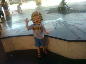
This weekend we took the Curious Kids to the California Science Center for the traveling Cleopatra exhibition. Although there were no mummies, the show was still a big hit, primarily because Finley got a King Tut crown.

The exhibit boasts the largest collection of artifacts from the Cleopatra era ever assembled in the U.S. Many of the pieces were recovered from the sea near Alexandria, Cleopatra’s capital city. Over hundreds of years the temples and treasures washed out to sea, a result of earthquakes, a tsunami and other natural forces. Underwater archaeology teams, led by Franck Goddio, have only discovered the ruins in the last couple of decades.

Another major portion of the exhibit discusses the search for Cleopatra’s tomb led by archaeologist Zahi Hawass. Hawass and his team now believe Cleopatra and Mark Antony may be buried in the temple of Taposiris Magna west of Alexandria. His team has not yet recovered a mummy.

If you are in the Southern California area, the exhibit runs through Dec. 31st. It’s a wonderful opportunity to inspire a budding archaeologist.

You can learn more about Cleopatra, ancient Alexandria and the temple:

Cultivating curiosity, Geography, Parenting

The Olympics: Studies in Geography and Perseverance

My children are obsessed with the U.S. Women’s Volleyball team and their quest for gold. The boys cheered on Destinee Hooker, Jordan Larson and the others during their first two matches against South Korea and Brazil. Now we are waiting for the Wednesday match against China. My oldest son also has asked to watch swimming and archery (inspired by the Marvel Superhero Hawkeye, I’m guessing). Though we don’t watch a lot of daytime TV, I’m indulging him, because the Olympics can be a valuable learning experience for curious kids.

The most obvious Olympics lessons include geography and map skills. With each volleyball match we look up the competing countries on the globe and read about them in our atlas. The Web site Living Montessori Now has some wonderful Olympic geography activities including DIY globes and a whole Montessori-inspired unit for those who are interested.

Still, I think the real value in the Olympics is teaching children the value of perseverance and mastery. The kids and I talk about what it takes to win gold and to be the best in the world. It requires some natural talent, luck and timing but also practice, practice, practice. In his book Outliers, Malcolm Gladwell writes that one reason greats like Bill Gates or the Beatles are so successful is they’ve accumulated 10,000 hours of experience and practice in their disciplines, essentially 20 hours a week for 10 years.

So let’s look at 17-year-old Missy Franklin, who just earned gold in the 100m backstroke. (Go Missy!) She’s extremely young, but she swims 2 to 4 hours a day 6 or 7 days a week, essentially 20ish hours a week. She started swimming 12 years ago at age 5, so she’s probably pretty close to the 10,000-hour mark despite her young age.

Now, before you go all “Tiger Mother” on your kids and force them to practice the piano for four hours a day, bear in mind that your child’s passion and desire has to underlie all this practice. Psychology Professor Todd Kashdan, author of Curious, had this to say on Huffington Post: “Try to ensure that the bulk of activities in their lives map onto their interests and give them challenges that push their skills to the limit,” he wrote. “Children need to feel a sense of ownership over their own actions instead of feeling controlled like ‘pawns’ by pressure, guilt, and the rules and regulations of adults.” With young children, it’s great to try out lots of things — not all at the same time — and see what sticks. They might try gymnastics today and cooking club next month. But once they really enjoy something, encourage them to master it.

Are you watching the Olympics with your children? What’s your favorite part of watching the games with your kids?

Books, Geography, History, Homeschool

Perfect Picture Book Friday: Mummies, Pyramids, and Pharoahs

Title: Mummies, Pyramids, and Pharaohs

Author/Illustrator: Gail Gibbons

Publication Info: Little, Brown and Company, 2004
Intended audience: preschool and up
Genre: nonfiction picture book
Themes/topics: ancient Egypt, geography, world history, civilizations
Opening and synopsis:
“One of the world’s oldest continuous civilizations began about five thousand years ago, in the land of Egypt. For the next three thousand years the Egyptians were ruled by kings called pharaohs. While he was in power, each pharaoh was believed to be Horus, the son of the great sun god, Re.”
Gail Gibbons provides an age-appropriate overview of ancient Egypt including social structure, religious customs, and, of course, mummies.
Why I like this book: Have I mentioned that my three-year-old is obsessed with mummies? Our visit to The Getty Museum, with its Roman mummy in April made an impression, and we’ve been reading books about mummies ever since. Gibbons’ book, which we’ve read approximately 100 times, is the clear favorite. Gibbons is a prolific nonfiction writer. Her picture books are perfect for preschooler audiences.
Resources: This book is a wonderful way to explore ancient Egypt. Online resources abound, so here’s just a few. The British Museum has wonderful mummy collection. Check out the museum’s young explorers’ online explorer to learn more about ancient Egypt. National Geographic has a lesson plan for grades three through five, here. The site also has fun games, including “Tomb of the Unknown Mummy Game.” Kids become Egyptologist to explore the tomb and solve the mystery. The site also has a Day in the Life brainteaser/quiz game for children. Scholastic boasts several lesson plans with Egyptian themes. For grades six through twelve, educators can find lesson plans on PBS. Really, opportunities to extend the learning from this book abound.
IMPORTANT NOTE: Susanna Leonard Hill’s Perfect Picture Book Friday will be on hiatus until September 7. I’ll be taking a bit of a blog-cation over the next month, but I’ll return with more book reviews in early August.
Every Friday bloggers review “Perfect Picture Books.” Find a complete list of book reviews organized by topic, genre and blogger at author Susanna Leonard Hill’s site.
Books, Geography, History

Perfect Picture Book Friday: The Story of Salt

Illustrator: S. D. Schindler
Publication Info: G. P. Putnam’s Sons, 2006
Intended audience: Ages 7 and up
Genre: nonfiction, picture book
Themes/topics: world history, economics
Opening and synopsis: “It began a few years ago with a rock I bought in a small mountain town in Spain. The rock had pink surfaces with streaks of white and brown. Though it was not a diamond or an emerald or a ruby, it was beautiful. Yet it was only salt.”
Are you ready to learn about the rise and fall of world civilizations? Then follow the salt trade through the ages, for he who controlled the salt, controlled the world. Salt built the Great Wall of China; during the Tang dynasty, half of the Chinese government’s funds came from salt. Mahatma Gandhi’s symbolic Salt March spurred Indian independence. And even in the United States, many towns were settled close to sources of salt.
Why I like this book: As a college history major, I love well-written hi-“stories,” especially those with such a narrow focus but broad historical impact. Kurlansky originally wrote “Salt: A World History” for grown ups in 2003, which I haven’t read….yet. However, for upper elementary, this is a fantastic story of how trade, commerce and the wrestle for resources lie at the center of so many wars and power struggles.
Resources: Eat a meal featuring salt-cured foods and discuss how salt allowed people to preserve food and travel far from home to trade. Think cheese, sauerkraut, pickles, ham, bacon, salt fish. You can make your own pickles using several recipes, but here’s one from Alton Brown at The Food Network. You could try your hand at making your own salt from seawater or saltwater you’ve prepared. Just pour it in a shallow bowl or plate and place it in the sun for several days. The GastroGnome has a stove-top recipe here. In my experience, children love mummies, and salt was vital to the mummification process. Discovery Kids has a mummy-maker game here.
Every Friday bloggers review “Perfect Picture Books.” Find a complete list of book reviews organized by topic, genre and blogger at author Susanna Leonard Hill’s site.
Books, Geography, Science/Math

Perfect Picture Book Friday: Me on the Map

Author: Joan Sweeney
Illustrator: Annette Cable
Publication Info: Knopf Books for Young Readers, 1996
Intended audience: 3 and up
Genre: nonfiction, picture book (32 pages)
Themes/topics: cartography, maps, geography, nonfiction
Opening and synopsis: “This is me. This is me in my room. This is a map of my room. This is me on the map of my room.” Step-by-step, this young girl shows the reader her room, her home, her street, her city, her state, her country and her planet and how each would appear on a map. This book is a wonderful way for children to learn about their place in the world and how it’s represented in two dimension.
Resources/activities: Taking a cue from the book, children can learn about scale and dimensions by drawing a map of their bedroom or home. For older children, you could use graph paper to teach scale, allowing the child to measure his or her room and pieces of furniture and plotting them on graph paper. You could also challenge a child to draw a map of a location from a favorite book using clues found in the text.
Why I like this book: This book is immensely popular. I had it on hold at the library forever. My five-year-old wanted to renew it as the due date approached, but someone else had already placed a hold on it. Simple language and strong visuals make this an excellent introduction to cartography.
Every Friday bloggers review “Perfect Picture Books.” Find a complete list of book reviews organized by topic, genre and blogger at author Susanna Leonard Hill’s site.
Geography, Science/Math

Where in the world am I? Make your own sextant

Homemade sextant to determine latitude

I’m continuing to try out activities for my picture book about navigation. Today, I built my own sextant, pictured above. It’s nothing fancy, just an index card, a straw, a paperclip and some tape. However, this simple tool can help you figure out your latitude, a navigational word for your north/south position.

Here’s how it works. There’s a special star visible in the northern hemisphere, called Polaris. It’s also known as the North Star. Polaris is in the handle of the Little Dipper. While other stars appear to rise in the east and set in the west, Polaris stays fixed in the night sky. It sits above the North Pole, so when you find it, you can determine north, south, east and west just as ancient sailors did.

At the equator Polaris appears on the horizon. Here, the latitude is zero degrees. At the North Pole, Polaris is at 90 degrees, directly overhead. Using a sextant, you can determine how far above the horizon Polaris sits. All you have to do is view Polaris through your sighting device, and make note of the angle. That angle is the same as your latitude. For example, if you spy Polaris 30 degrees above the horizon, your latitude is 30 degrees north.

Here’s a great video tutorial for making your own sextant. Let me know if you try it and how well it works.